State and Regional Water Planning
Texas plans for future water needs through a regional process administered by the Texas Water Development Board. Sixteen regional water planning groups evaluate projected water supplies and demands, identify potential shortages during drought, and recommend strategies and projects to meet the needs of municipal, agricultural, industrial and other water users.
These regional plans are incorporated into the State Water Plan, which is updated every five years and considers water needs over a 50-year planning horizon. North Plains GCD is located within the Panhandle Regional Water Planning Area, known as Region A. Groundwater from the Ogallala Aquifer is the region’s primary water source.
- View the 2027 Texas State Water Plan
- View the TWDB Region A Planning Group page
- View the Region A Panhandle Water Planning Group
- View Groundwater Management Area 1 website
Region A Water Planning Group
The Panhandle Region A Water Planning Area includes 21 counties across the Canadian and Red River basins. The group coordinates long-range water planning for the region, where groundwater from the Ogallala Aquifer remains the primary water source.
Groundwater Management Area 1
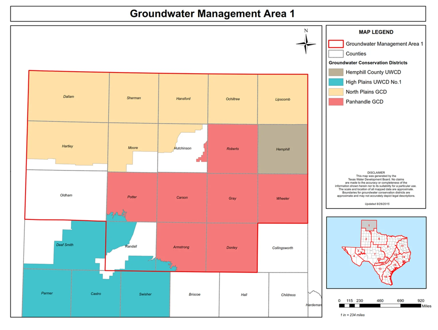
North Plains GCD participates in Groundwater Management Area 1 to coordinate groundwater planning with neighboring conservation districts that manage shared aquifer resources. This regional process helps districts align groundwater management goals and groundwater-availability determinations across district boundaries.